Map - Chagang (Chagang-do)

Chagang (Chagang-do)
Chagang Province (Chagangdo; ) is a province in North Korea; it is bordered by China's Jilin and Liaoning provinces to the north, Ryanggang and South Hamgyong to the east, South Pyongan to the south, and North Pyongan to the west. Chagang was formed in 1949, after being demarcated from North Pyongan. The provincial capital is Kanggye. Before 2019, Chagang was the only province of North Korea completely inaccessible to tourists, possibly due to weapons factories and nuclear weapon facilities located there. In 2019 the city of Manpo became accessible to tourists. In May 2018, the province became a "Special Songun (military first) Revolutionary Zone" in relations to concealing the nuclear weapon and weapon's factories within the province.

Chagang Province is located in the northwestern part of Korea. It is a mountainous province; with the mountainous area amounting to 98 per cent of its total area. The mean height above sea level is 750 meters and the slope of most regions is 15 to 40 degrees.

The province has a distinct continental climate under the influence of the Asian continent. It has very cold and long winters, and brief springs and falls. The climate is characterized by great differences in daily and yearly temperature. In summer, downpours of rain and hail are frequent. Thus thunder and lightning occur frequently.

The province has great mineral wealth, and is North Korea's main source of lead, zinc, gold, copper, molybdenum, tungsten, antimony, graphite, apatite, alunite, limestone, calcium carbonate, anthracite and iron ores. There are also crystals and valuable gems there.

 
Map - Chagang (Chagang-do)
Map
Google - Map - Chagang
Google
Google Earth - Map - Chagang
Google Earth
Openstreetmap - Map - Chagang
Openstreetmap
Map - Chagang - Esri.WorldImagery
Esri.WorldImagery
Map - Chagang - Esri.WorldStreetMap
Esri.WorldStreetMap
Map - Chagang - OpenStreetMap.Mapnik
OpenStreetMap.Mapnik
Map - Chagang - OpenStreetMap.HOT
OpenStreetMap.HOT
Map - Chagang - OpenTopoMap
OpenTopoMap
Map - Chagang - CartoDB.Positron
CartoDB.Positron
Map - Chagang - CartoDB.Voyager
CartoDB.Voyager
Map - Chagang - OpenMapSurfer.Roads
OpenMapSurfer.Roads
Map - Chagang - Esri.WorldTopoMap
Esri.WorldTopoMap
Map - Chagang - Stamen.TonerLite
Stamen.TonerLite
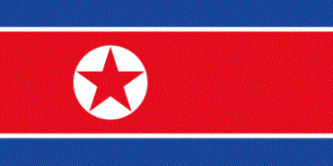
Country - North_Korea
Flag of North Korea
North Korea, officially the Democratic People's Republic of Korea (DPRK), is a country in East Asia. It constitutes the northern half of the Korean Peninsula and shares borders with China and Russia to the north at the Yalu (Amnok) and Tumen rivers, and South Korea to the south at the Korean Demilitarized Zone. North Korea's border with South Korea is a disputed border as both countries claim the entirety of the Korean Peninsula. The country's western border is formed by the Yellow Sea, while its eastern border is defined by the Sea of Japan. North Korea, like its southern counterpart, claims to be the legitimate government of the entire peninsula and adjacent islands. Pyongyang is the capital and largest city.

In 1910, Korea was annexed by the Empire of Japan. In 1945, after the Japanese surrender at the end of World War II, Korea was divided into two zones along the 38th parallel, with the north occupied by the Soviet Union and the south occupied by the United States. Negotiations on reunification failed, and in 1948, separate governments were formed: the socialist and Soviet-aligned Democratic People's Republic of Korea in the north, and the capitalist, Western-aligned Republic of Korea in the south. The Korean War began in 1950, with an invasion by North Korea, and lasted until 1953. The Korean Armistice Agreement brought about a ceasefire and established a demilitarized zone (DMZ), but no formal peace treaty has ever been signed.
Currency / Language  
ISO Currency Symbol Significant figures
KPW North Korean won â‚© 2
ISO Language
KO Korean language
Neighbourhood - Country  
  •  China 
  •  South Korea 
  •  Russia